
MIDI-PYRENEES - an area guide
Discover the heart of southwest France
- Explore France ►
- Essential pages
- Travel in France
- Where to go
- What to see and do
About-France.com
- the connoisseur's guide to France
A guide to the Midi-Pyrenees area of Occitanie
| Page index : | Regional overview | Main tourist sites | More information |
 Since
2016, "Midi Pyrenees" has been merged with neighbouring Languedoc into
a new super-region called
"Occitanie" - a historical reference to the part of
France where until the nineteenth century most people spoke varieties
of Occitanian French, not the standard French of northern France.
Since
2016, "Midi Pyrenees" has been merged with neighbouring Languedoc into
a new super-region called
"Occitanie" - a historical reference to the part of
France where until the nineteenth century most people spoke varieties
of Occitanian French, not the standard French of northern France. Unlike many areas of France Midi-Pyrénées is not a historic province. It is actually a 20th century invention, created as a result of the "regionalisation" process that took place in the 1970s. Like the Pays de la Loire region further north, Midi-Pyrénées was established in order to create a region around a regional metropolis, in this case the city of Toulouse.
The modern Midi-Pyrenees region was made up out of all or a large part of different historic areas, including parts of the large former provinces of Guyenne, Gascony, and Languedoc, and smaller areas, within these larger areas, such as Rouergue and Quercy, the Albigeois, and the county of Foix.
The largest region in France:
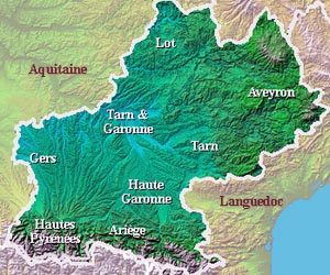
Midi-Pyrénées was the largest administrative region in metropolitan France, in terms of surface area, and equal largest in terms of the number of departments covered. It incorporates eight departments, which are Ariège (09), Aveyron (12), Haute-Garonne (31), Gers (32), Lot (46), Hautes-Pyrénées (65), Tarn (81) and Tarn-et-Garonne (82). The region covers a total surface area of 45,348 km², making it larger than either Belgium or Switzerland; and stretching some 400 kilometres from north-east to south-west, it is not surprisingly a region that somehow lacks any strong regional identity. Within this region, towns and traditions tend to identify themselves more with the historic provinces to which they once belonged, than to the modern-day region.Regional towns and cities
The city of Toulouse, lying more or less in the centre of the region, is by far the biggest city. Although this is the largest region in France, over a third of the entire population live in the Toulouse urban area, and the Haute Garonne department, surrounding Toulouse, accounts for well over 40% of the regional population. The region's second largest urban area, surrounding the city of Tarbes, capital of the Hautes Pyrenees department, is ten times smaller than the Toulouse urban area. The only other towns with a population of over 40,000 are Montauban, Albi and Castres.
A rural region
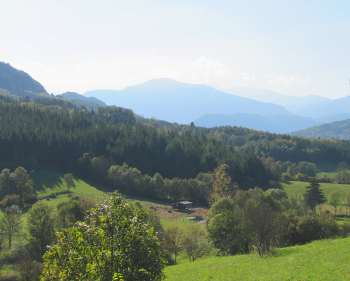 Alpine scenery
in the rural Ariège Pyrenees
Alpine scenery
in the rural Ariège PyreneesThe region also has sizeable vineyards, such as in the areas round Gaillac, north of Toulouse, and the Armagnac area, which lies partly in Midi-Pyrenees, partly in Aquitaine. However this is not one of France's greatest wine producing areas.
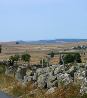 the Aubrac
plateau
the Aubrac
plateauAt the southern end of the region, the Pyrenees, rising to over 3000 metres on the Spanish border, offer all the attractions of a high mountain area - in both summer and winter. This is real mountain country, where wooded foothills give way to mountain pastures and open terrain at higher altitudes. This area is popular with skiers in winter, and with ramblers and other outdoor enthusiasts in the summer months; it also containes one of the few National Parks in France., as well as the world-famous pilgrimage centre of Lourdes.
Access:
by
train (TGV) from Paris Gare Montparnasse or Gare de Lyon. For
train tickets and timetables, visit Trainline.com
Access by car from the UK, via any of the Channel ports, from Roscoff (Brittany) to Calais. See route map from Calais.
Access by air: Toulouse-Blagnac is one of the best served of France's regional airports. There are also airports at Lourdes, and Rodez with flights from the UK. See Flights to France
Main tourist attractions in Midi-Pyrénées
- Toulouse (31), Regional capital; the "Ville rose", or pink city, on account of the warm colour of the local brick. Cathedral, Canal du Midi, Place du Capitole. Musée des Augustins, Fondation Bemberg gallery ►More on Toulouse
- Albi: (81) UNESCO world heritage site - Historic city on the Tarn, with a unique medieval redbrick fortified cathedral. Also the Toulouse Lautrec art gallery, old town, and riverscape on the Tarn. ► More on Albi
- Castres (81). Goya museum, with a major collection of Spanish art.
- Cordes
sur Ciel. (81) Small medieval town perched dramatically
on a hilltop above the river Cérou.
===================== - Tarbes: (65) genteel town in the foothills of the Pyrenees
- Lourdes (65) The most famous Catholic pilgrimage centre in France, where the Virgin Mary appeared to a peasant girl in1858
- Pyrenees
National Park (65) spectacular area of high mountain,
including the Cirque de Gavarnie.
===================== - Foix: (09) historic capital of the Ariège, with impressive "Cathar" castle
- Niaux: (09) Grotte de Niaux, fine prehistoric cave paintings. One of the rare sites of prehistoric art where the actual caves are open to the public
- Mas
d'Azil (09) Underground river. Drive right
through a massive cavern on the D119. Visit the prehistoric grotto, one
of the earliest human habitats in Europe. See Prehistoric France
===================== - Rodez: (12) capital of the Rouergue. Large 14th century cathedral, old city centre. Musée Fénaille with world class collection of prehistoric carved menhirs. Soulages museum. Brand-new museum with 500 works by contemporary master Pierre Soulages. ► More on Rodez.
- Roquefort: (12) visit the caves, where the famous cheese is matured.
- Millau (1 2) The Millau viaduct, the world's highest road bridge, and southern entry point for the Gorges du Tarn
- La Couvertoirade (12) Old fortified village of the Knights Templar, on the Larzac plateau
- Conques.
(12) One of the finest romanesque churches in France, with
remarkable sculptures. (UNESCO world heritage site). See gallery Conques
===================== - Cahors (46) The capital city of the Lot department is famous for its old streets and its unusual fortified medieval bridge.
- Martel (46) : Haut Quercy railway. Scenic railway, 6.5 km long, offering steam trains most days from mid July to end of August.
- Rocamadour (46): A major pilgrimage and tourist site, this small town clings to the side of the Alzou canyon, in the Lot department.
- Saint Cirq Lapopie (46) : beautiful and unscathed historic village in the valley of the Lot. Certainly worth a visit - but very crowded in peak summer season.
- Pech Merle (46) near Cahors. Underground gaves with prehistoric paintings and stalagmites. See Prehistoric France
- Padirac
(46) near Gramat. Huge natural sinkhole leading to an
underground cave system with river and rock formations
===================== - Montauban (82) Medieval bridge, 18th century cathedral and renowned Ingres Museum, devoted to the great French neoclassical artist.
- Bastide towns:
Many of these famous fortified medieval towns are in this
region
===================== - Gers department (32): See Gascony
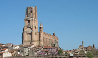
The historic centre of Albi, a UNESCO world heritage site, dominated by its unique medieval fortified St. Cecelia's cathedral.
Accommodation
Click for a choice of Small
hotels in Midi-Pyrenees
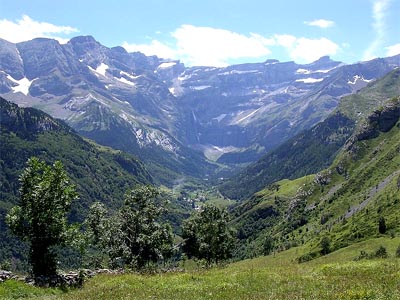
The High Pyrenees National Park
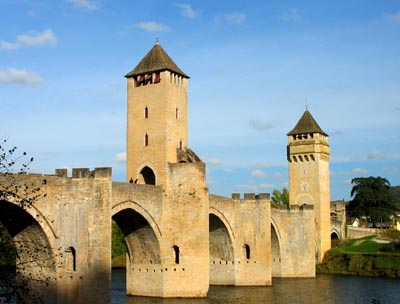
Famous fortified medieval bridge over the Lot, at Cahors
Photos on this page, copyright About-France.com
except for the Rocamadour and High Pyrenees pictures, which are published under the GNU licence.
About-France.com
Home
page - Site
search
- Regions
- Maps of France
- Contact
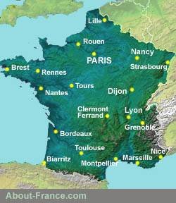
Occitanie region
-
Midi-Pyrenees area
The capital
city Toulouse, lying
in the centre of the Midi-Pyrenees area, is the only big metropolitan
area in the region which is otherwise a region of small
towns, villages, and rolling countryside.
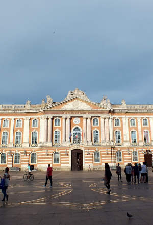
Toulouse, Place du Capitole - one of Europe's finest urban piazzas
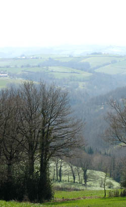
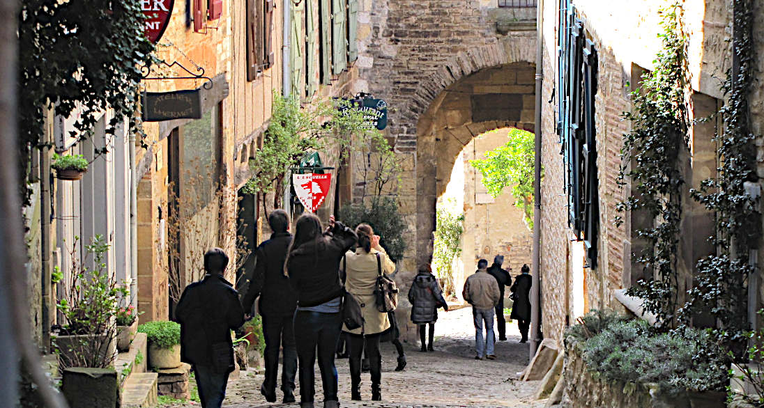
In the
depths of rural Tarn
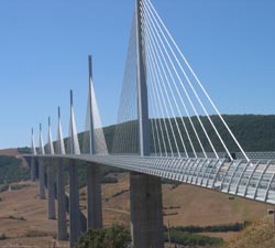
The Millau viaduct, in the Aveyron department
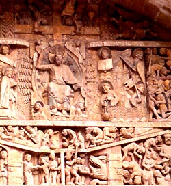
Conques - part of the remarkable medieval tympanum (More photos: see Conques photo gallery)
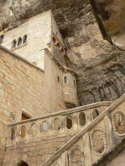
Rocamadour, in the Lot
Photo Patrick Clenet
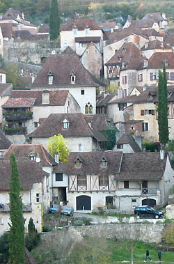
Saint Cirq Lapopie, in the Lot - one of the "plus beaux villages de France" which really deserves the title.
About-France.com
is an independent and free travel information guide, funded
solely
through affiliate commission that may be earned on bookings made
through selected partner websites.
Click here for
low-cost car hire in France
low-cost car hire in France