Routes from Cherbourg
Cherbourg (or Caen) to south and west France, Spain and Italy
About-France.com
- Explore France ►
- Essential pages
- Travel in France
- Where to go
- What to see and do
Easy driving holiday routes through France
Zoomable and movable interactive route map, with accommodation markers. All accommodation is easily accesible from road or motorway exits. See below for marker key.
This map is shows six recommended routes (numbered 1 to 6) from Cherbourg, to France, Spain and Italy.
If landing at Caen (Ouistreham), follow signs for A 84 Rennes to reach routes 1 to 3, and signs for Falaise and Alencon to get onto routes 4 to 6.
The routes chosen are not necessarily the fastest nor the shortest; they may be one or the other, they may be both.... but they have been chosen as the routes with least hassle and easiest driving.
Most of the time these routes follow motorways - but sometimes, when there is a better or easier or shorter route that uses non-motorway roads, it has been chosen. General details are given in the summary route guides below.
Take
care: when zooming or moving the map, do not click on
the actual route line itself, as it may disappear. You may also cause
the map to move to a different route. To get back to where you were
before, the easiest thing is to reload the page.
| Map Key:
Easily accessible hotels |
|
 Quality 3 or 4-star classic independent hotels
with character Quality 3 or 4-star classic independent hotels
with character
|
|
 Upscale
chains such
as Mercure or Holiday Inn Upscale
chains such
as Mercure or Holiday Inn
|
|
 Midscale chains such as
Campanile, Kyriad, Ibis or Ibis
Styles Midscale chains such as
Campanile, Kyriad, Ibis or Ibis
Styles |
|
 Budget hotels - 1 star or 2
stars.
Ace, Ibis Budget,
F1 and others Budget hotels - 1 star or 2
stars.
Ace, Ibis Budget,
F1 and others
|
|
 Hotel
clusters: more than one hotel of
different categories Hotel
clusters: more than one hotel of
different categories
|
|
With ferries from Portsmouth and Poole, run by Brittany Ferries Cherbourg is a popular entry point into France for travellers heading south and west. It is also a convenient landing point for drivers heading towards the Alps and Italy, but wanting to avoid the busiest French motorways around Paris.
Route guide from Cherbourg
All routes out of Cherbourg - for whatever destination more than 50 kilometres away - leave on the same road, the dual-carriageway N13, which is followed for about 60 km as far as just after Carantan. Here western routes 1, 2 and 3 head south on the dual-carriageway N174 / E3 route, signposted St. Lo, while southern and southeastern routes 4, 5 and 6 continue on the N13 towards Caen.
Routes 1, 2 and 3 - western and southwest France
From Saint Lo, there are two options for continuing to the next key point on the route, Avranches. Either leave the N174 at exit 5 marked St. Lô, or continue on on the N174.If you leave the N174, then take the D999 southwest, following signs for Percy and St. Samson. It's 33 km along this gently winding, then straight road as far as the entrance to Villedieu les Poêles, just after Percy, where you will join the A84 (free) motorway. If you continue on the N174 at Saint Lô, you'll reach the A84 at Guilberville, where you turn left onto the motorway, signposted Rennes etc.. This is 43 km, so 10 km. longer than the other option , but all dual carriageway.
Once on the A 84 just keep following signs for Rennes.
Route 1 - Brittany. At Exit 34 by Pontaubault, Route 1 towards Brittany leaves the A 84 to follow the dual-carriageway N175 then N176 signed Mont Saint Michel, St. Malo & St. Brieuc. After 90 km, at Tramain, the N 176 joins the N12 which continues as far as Brest.
Routes 2 and 3, for southwest France, Spain and Portugal, continue on the A 84 as far as Rennes. At the entrance to Rennes, take the orbital ring road to the east, following the signs for Nantes. You are now on the dual-carriageway N136, which you will leave at Exit 6a, following the sign for Nantes. Its a round and over cloverleaf exit, which will put you on the N137, signposted Nantes.
At the entrance to Nantes, turn right onto the A844 signposted Bordeaux. You can now follow the signs for Bordeaux for the next 350 km, or else leave the A 83 (toll) at Exit 7, for La Rochelle and the Atlantic coast.. The A 83 motorway south from Nantes is a toll road after exit 2, where there is an option to follow a toll-free route to La Rochelle and Niort.
Drivers following route 3 for Bordeaux and beyond are advised to stay on the toll motorways, as the journey is a long one.
Routes - 4, 5 and 6 - South of France, Costa Brava
At Saint Lo, continue on the N13 as far as Caen, where you follow the southern ring road, exiting south at Exit 13 "Porte d'Espagne to follow signs for Alençon and Le Mans. You are now on the N158 which becomes the A 88 toll motorway (with very little traffic) after Falaise. Once you're on the toll motorway system, the directions are easy. Follow Le Mans as far as Le Mans, where you briefly take the A11 in the direction of Paris, following signs for the A28 for Bordeaux and Tours. which turns south off the A11 after 6 km.Just before Tours, follow the sign for A10 Tours / Vierzon / Bordeaux. It is now Vierzon that you will keep following. Just south of Tours, turn off the A10 to follow the A 85 signposted Vierzon and Lyon. At Vierzon, the A85 joins the A71 which you'll follow as far as Clermont-Ferrand, which is clearly signposted all the way.
Routes 4 & 5 after Clermont Ferrand
At Clermont Ferrand, drivers on routes 4 and 5 continue straight on on the A71 which turns into the toll-free A75 which will be followed as far as Exit 20 at Lempdes (for route 5 to Provence) or to the end of the motorway at Béziers (for route 4 to the Mediterranean).
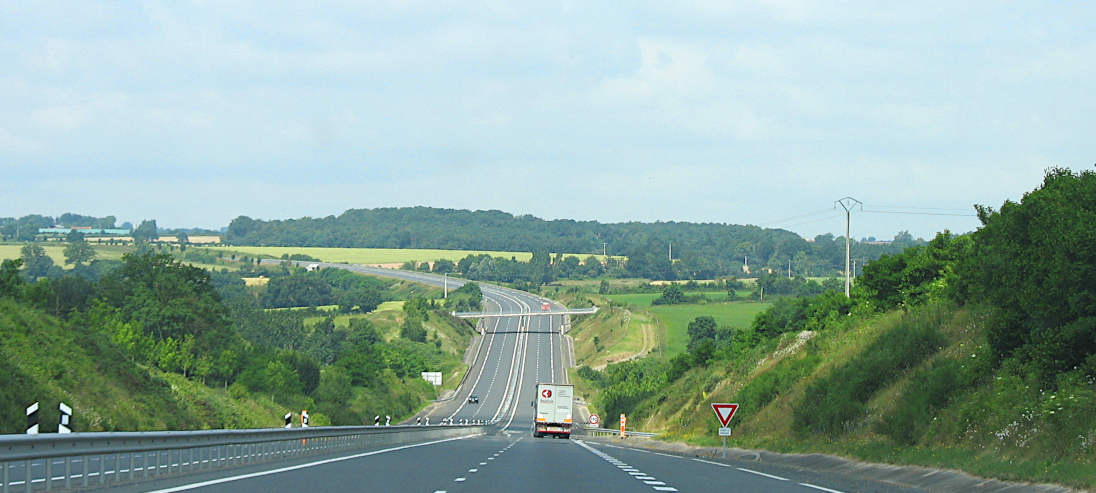
Route 4 follows the free A75 across the top of the Massif Central mountains, with three cols at over 1100 metres altitude. It's a beautiful drive, and relatively traffic-free except on holiday Saturdays. If travelling this route on a Saturday in July or August, take on fuel before or after Clermont Ferrand, as the motorway service stations on this section of the route cannot cope with peak demand, and there can be huge queues.
After the stunning 700 metre altitude drop off the Larzac plateau to the Mediterranean plain at le Pas de l'Escalette (motorway speed limited to 70 km/h in parts), you have the option of turning east on the A750 to Montpellier, or continuing on to Beziers, where the A75 joins the A9 toll motorway which should be followed for the rest of the journey to the Spanish border.
Route 5 for Provence: take Exit 20 off the A75, marked Le Puy en Velay. This now follows the N102 as far as Montelimar, in the Rhone valley. Most of this is single carriageway, with three lane overtaking sections and a few sections of dual carriageway. There are fabulous landscapes and traffic is light. Keep following signs for Le Puy en Velay, then for Aubenas, then for Montélimar. The road climbs to over 1200m altitude, before winding down through the spectacular high Ardèche valley to Aubenas.
At Montélimar or Viviers or Pont Saint Esprit, depending on the route you take after Aubenas, it's worth joining the A7 toll motorway, as traffic can be fairly dense on the non-motorway routes which have multiple roundabouts.
Route 6 after Clermont Ferrand
At Clermont Ferrand, drivers following route 6 in the direction of the Alps and Italy will turn off just after the toll booth to follow the A89 in the direction of Lyon. At the entrance to Lyon, follow signs for E70 A6 Geneva Grenoble and St Exupéry airport, which will take you round the relatively uncongested northern outer ring road. You'll find yourself heading north for a few kilometres, which may seem wrong, but isn't. You'll then turn off onto the E15 E70 A466 marked Geneva and Grenoble. This is far easier driving than getting into Lyon and grappling with traffic on the inner ring road. Once out of Lyon and onto the A43 motorway, keep following the signs for Turin, Annecy or Chambéry, according to where you are heading.
About-France.com
Home page -
Site search
- Regions
- Maps of France
- Contact
Hotels
along the way

Le Mans
Tours
Vierzon
Lyon
Nantes
Bordeaux
Clermont-Fd.
Other areas
About-France.com
is
partnered with Booking.com,
to
bring you the best online prices.
About-France.com
is an independent guide to France, free of external advertising. Pages
may contain links to useful external websites, including
government websites and other official sources, as well
as
affiliate links to relevant travel service providers. A small
commission may be earned from purchases made through these
affiliate links.
Other
places, other countries...
Partner websites
Institutions, life and tourism- About Britain - a thematic introduction to Britain covering institutions, life and tourism
- Angleterre.org.uk - Le guide de l'Angleterre, en français
Travel and tourism
- About Quebec - Discover the French-speaking province of Canada
- About California - a thematic travel guide to California
- About-Portugal.com - Discover Portugal and its regions
- About Spain - discover the real Spain - an incomplete guide to Spain on and off the beaten track
- About the USA - a thematic guide to the United States.
About : About-France.com is a Travel-Webs site

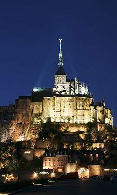
Mont St Michel, Normandy (just off routes 1 and 2)

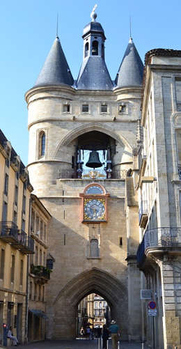
Bordeaux (Route 3)

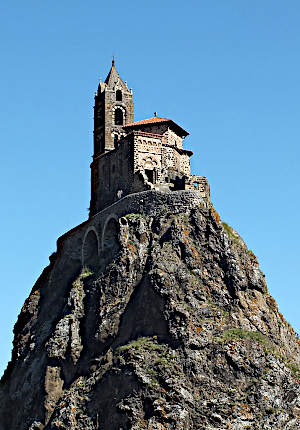
Small city off the beaten track - Le Puy en Velay in Auvergne (Route 4)
