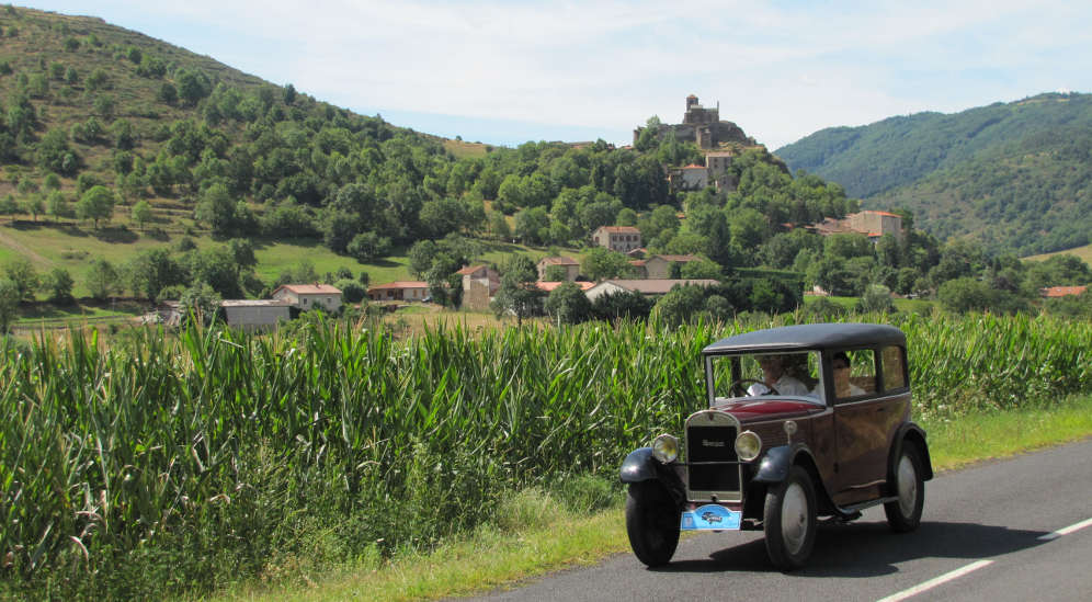
Byroads through the Auvergne
Slow
travel through France to the Mediterranean
Part
2
About-France.com
- Explore France ►
- Essential pages
- Travel in France
- Where to go
- What to see and do
About-France.com
- the connoisseur's guide to France
| On this page | Route description | Route map and accommodation |
In
part 1 of this guide to Byroads
through France, we took you on byroads from Rouen, in
Normandy,
as far as Saint Amand
Montrond, the small town that is located closest
to the geographic centre of continental France.
Part 2 takes
you on from Bourges or Saint
Amand, from the
northern
to the southern limits of the Auvergne
region, from the
valley of the Cher to the high plateaux of the Massif Central.
Where
to stay
About-France.com has selected a range of hotels along the route. Click markers to book online with our partner Booking.com. There are also campsites and motorhome overnighting areas in many of the small towns along the way.
For electric vehicles ⚡: Finding hotels with EV charging points is not always easy, but we've located EV-friendly hotels in Bourges, Thiers, Brioude and Chateauneuf de Randan. Check the hotel markers on the map for these locations.
Byways through France 2: From the centre of France to the marches of Occitania
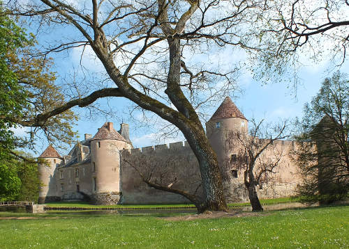
The Château of Ainay le Viel, surrounded by its moat, is one of France's hidden gems
Other map markers: the clickable o markers on the route locate and give very brief information on places described in the route guide. Zoom in on map to separate markers.
Leave Saint Amand Montrond on the D2144 (former N144) signposted Montlucon. At the hamlet of Meslon,turn right on the D1 for Ainay le Vieil ★★ where you can visit one of the most charming small chateaux in France, a defensive 14th century chateau surrounded by a lily-filled moat. (Open April - October)
Return to the D2144 and continue south in the direction of Montlucon. You are now in the region of the Auvergne. After 6 km, fork left onto the D978A, signposted Cerilly and Bourbon Arch. You will soon find yourself in the ancient forest of Tronçay ★★, which used to provide the timbers for the French navy in the olden days . After about 12 km of forest road, in the middle of the forest, turn right for Cerilly ★ on the D953. Cerilly is a sleepy little town with an early medieval church with a curious-shaped tower. From Cerilly keep heading southeast on the D953 to Ygrande ★ , which is another small town with a twelth-century church with a large stone spire. From Ygrande, continue on the D953 to the local market town, and former capital of the Bourbons , .
Bourbon l'Archambault ★★ is an attractive small town, dominated by the great mediaeval fortress of the Bourbons; vestiges of the city walls still survive to this day, and the town also has a 12th century romanesque church in the local style.
At Bourbon, you leave the D953 and head southeast on the D134 which will take you as far as the small town of Souvigny.
Souvigny ★★ is another very attractive small town, and its great priory, built in the 12th century, was one of the five major priories depending of the great Benedictine abbey of Cluny, the largest in Western Europe.
After Souvigny, continue southeast on the D34 to Besson, then follow the D232 signposted Chatel de Neuvre. Here you will join the D2009 (once upon a time the N9), onto which you turn south and follow as far as Saint Pourcain.
From Besson to Saint Pourçain sur Sioule ★ you pass through an AOP vineyard area. It's a small vineyard area, with 600 hectares of vines spread over a large area; but it's growing, and it's the only vineyard area you'll go through on this route. You'll see the occasional vineyard beside the road, and wines can be tasted on some estates, or at the Cave coopérative in Saint Pourçain (visits and tasting).
To leave Saint Pourçain, cross the bridge, then at the first roundabout turn right following the green and blue signs for Clermont Ferrand. After 4 km, at the roundabout, turn left to follow the D6 signposted Vichy . Follow the D6 for 22 km, through Bellerive, then over the bridge to Vichy on the other side of the river Allier.
Vichy ★★ is an attractive small spa town, known for its naturally-carbonated mineral waters, for its belle-époque ambiance, and for having been the seat of the Pétain government in France during the Second World War. It's a small town with fine parks, an opera house, spas, a large lake, and plenty of shops. There's on-street parking, and the famous waters can be tasted for free at the Célestins spring, beside the Boulevard Kennedy (turn right after the bridge). There are also plenty of hotels .
Leave Vichy following the blue motorway signs for A89 and green signs for Thiers and Le Puy. You will soon find yourself on the D906, which you will follow all the way to La Chaise Dieu.
35 km south of Vichy, and just off the D906, the small town of Thiers ★★ is worth a visit. It is the French capital of cutlery, or coutellerie, knife-making. The ancient upper city hangs precariously to the side of a steep hill, down which surging waters have for over 700 years provided the power to turn the lathes for making knives.Some 70% of the knives made in France are made in Thiers, and there are all sorts of knife shops, craft workshops, several museums, factory visits and other attractions.
Return to the D906 to continue your journey south, following signs for Le Puy and Ambert. It is 50 km to Ambert. Well before you reach Ambert, you'll feel that you're entering the mountains, as the road begins to twist and turn: but for the time being you'll be mostly in the valley, with forested hills all round. This part of France is known as the Monts du Forez.
Ambert ★ is a tranquil small town in a valley. it is best known for its circular town hall, once the town's grain store, and for the historic Richard de Bas paper mill ★★ and museum. Four kilometres east of the town, this mill has been making paper in the traditional way since the 14th century, and still does so. It's a unique piece of Europe's industrial heritage.
From Ambert it's another 30 km to La Chaise Dieu. As you climb up to this historic site, standing at an altitude of 1000 metres, the road winds gently up through spruce forests.
La Chaise Dieu★★ is known throughout France for its music festival (late August) and for its great Benedictine abbey church, dating from the 11th-14th centuries. The abbey is known worldwide for its unique late medieval frescoes portraying the Danse macabre, or Dance of Death. The town itself is small, just over 600 inhabitants, a cluster of houses and a few small shops round the great abbey.
Note. From Ambert to La Chaise Dieu, there is also a heritage railway line operating in July and August. No steam trains, but a panoramic diesel railcar or open--top cariages.
Leave La Chaise Dieu on the D499 following signs for Brioude. After 4 km the D499 turns right. You continue straignt ahead on the road that is now the D19, for a 30 km drop down to Brioude. At Lamothe, turn left at the roundabout to cross over the river Allier which you last crossed in Vichy. Continue straight ahead following signs for Brioude centre at the next roundabout. As you enter Brioude, there is a large free car park on the right, just after the railway bridge (parking "Centre historique").
Brioude ★★ is one of the most attractive small towns in France, one of Michelin's small towns that are worth the detour, and an art and history area. Its Saint Julien basilica, with the relics of the saint who was martyred here, is the biggest romanesque church in Auvergne and one of the finest in France, getting a top Michelin ★★★ ranking. It has fine frescoes, and a unique mediaeval mosaic floor. Brioude also has an aquarium, a lace-making museum and art shops and galleries.
After Brioude, you'll travel down the beautiful Haut Allier valley★★ with a whole succession of delightful small towns and villages. Leave Brioude on the D912, following signs for Vieille Brioude. In Vieille Brioude ★, go through the village to admire the fine single-arch stone bridge over the river Allier. There is also a wine-making museum just beside the church before the bridge. No need to cross the bridge, as you're going to come back and take the D585 which will take you down the west bank of the Allier, in the direction of Lavoûte-Chilhac.
Eight kilometres south of Vieille Brioude, admire the site of the castle of Saint Ilpize ★, on a rocky outcrop high above the river. If you want to visit it, turn left at Villeneuve d'Allier, and cross a fine 19th century suspension bridge, and up to the castle, which is free to visit at all times.
From Villeneuve, continue down the D585 to Lavoute Chilhac ★. This delightful large village, classed as one of the plus beaux villages de France, has an impressive medieval hump-backed single-span stone bridge over the Allier. Just beyond it, the 14th century priory, hidden behind an impressive 18th century crescent, is worth a visit.
Don't cross back over the bridge. Leave Lavoûte on the D4, then keep following signs for Chilhac. Chilhac ★ is a very pretty village, perched on the top of a volcanic outcrop. It is the site of some of the oldest recorded traces of human life in Europe, and the small paleontolotgical museum is worth visiting.
Leave Chilhac on the D41, which drops down to the river Allier. Admire the impressive basalt organ rocks at the base of the cliff below the village, then cross the Allier on another suspension bridge, and continue along the D41 until it meets the D585 again, which you now follow to Langeac.
Continue south out of Langeac on the D585 following Saugues. After 6 km admire the village of Chanteuges ★, nestled on the side of another volcanic outcrop. You can drive up to the top of the outcrop to visit the romaneque 12th century abbey.
A mile after Chanteuges, (not recommended for camping cars, which should continue on the D585 to Saugues) turn left onto the D30 signposted Saint Arcons, Prades and Haut Allier - les gorges. Admire the very pretty village of Saint Arcons, then turn right onto the D48 following Prades. You'll pass beside a little mediaeval church standing all on its own - a historic 13th century pilgrimage chapel Sainte Marie des Chazes, before reaching Prades.
Prades ★ is as far as the road goes into the Allier gorge. The small village is dominated by an extremely impressive cliff made up of towering basalt "organ rocks"
Remain on the west bank of the river, and leave Prades following the C7 up out of the deep valley in the direction of Saugues. After 9 km turn right onto the D589 for the last 10 km to Saugues, a small town lying at an altitude of 1000 metres. This is the last town in the Auvergne.
Head south out of Saugues, still on the D585, following Esplantas to continue south on byroads, or alternatively follow the signs to the A75 motorway to carry on south on a faster route, or return north. You will now be driving for much of the time at altitudes of up to 1300 metres... so this route is not recommended in winter. On the other hand, the wild flowers in spring and early summer are beautiful up in this very remote part of France.
After Esplantas, keep following the D585 in the direction of Grandrieu, which is the first small town in the department of the Lozère and the Languedoc area.
You will now continue through Chateuneuf de Randan ★ , where you pick up the N88 to drop down to the small capital city of the Lozère, Mende.
From here, different routes south are possible, depending on which part of the Mediterranean coast you are heading for.
► NEXT: Continue south with Byroads through the Cevennes for routes through the Cevennes national park, and on down to the Camargue, and through the Languedoc, past Carcassonne, and finishing at the point where the Pyrenees meet the Mediterranean.
► More on Auvergne: see Auvergne regional guide
About-France.com
Home page -
Site search
- Regions
- Maps of France
- Contact
| Other routes through France ..... |
| ► Toll-free route from Calais to Bordeaux Bayonne and Irun (Spain) |
| ► The fastest routes south, with tolls |
To reach Saint
Amand Montrond, the start of this second stage of a
journey on byways through France, you
can either follow part
1 of this
guide, or else come down faster from Calais using the main route south
via Rouen and Orleans.
Saint Amand Montrond is 5 km from Exit 8 on the A71
Orleans-Clermont-Ferrand motorway.
About-France.com
is an independent user-supported website
that does not track visitors and carries very little advertising, We
may receive commission from sales made
on selected partner websites accessible through
affiliate links.
Gitelink
France
selected holiday cottages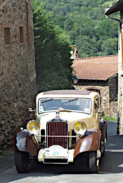
Through a small village in the Auvergne
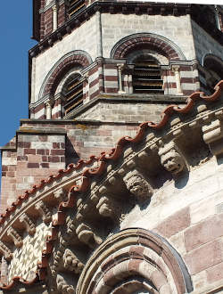
Medieval stonework on St Julien's basilica in Brioude
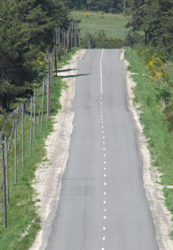
South of Saugues
Click here for
low-cost car hire in France
low-cost car hire in France
Website text and photos © copyright About-France.com renewed 2025 unless otherwise stated


