
Byroads through Languedoc & the Cévennes
Slow
travel through France to the Mediterranean
Part 3
About-France.com
- Explore France ►
- Essential pages
- Travel in France
- Where to go
- What to see and do
About-France.com
- the connoisseur's guide to France
| On this page | Route description | Route map and accommodation |
Part
3 of a route guide to leisurely motoring through France.
This
final stage offers a choice of routes from north of Mende, capital of
the Lozère
department, to the Mediterranean. The eastern
route takes you
through the beautiful Cévennes
national park, to a final destination at Les
Saintes Marie de la Mer, in the Camargue.
The western
route takes you through the Tarn
Gorge, over the High Languedoc regional park
and down to Carcassonne,
before winding through Cathar
country to the coast near Perpignan.
Where
to stay
About-France.com has selected a range of hotels along the route. Click markers for more details. There are also campsites and motorhome overnighting areas in many of the small towns along the way.
For electric vehicles ⚡: Finding hotels with EV charging points is not always easy, but we've noted EV-friendly hotels in Chateauneuf de Randan, Florac, the Tarn Gorge and Carcassonne. Check the hotel markers on the map for these locations
Byways through France 3: Languedoc - Cevennes : From the Lozère to the Camargue or to Carcassonne and the Pyrenees


This leg of the journey starts at Chateauneuf de Randan, one of the highest small towns in France outside the Alps. The town stands on a rocky outcrop overlooking the surrounding area, a part of France was much fought over during the Hundred Years War. Chateauneuf de Randan ★ was the stronghold of the baron Du Guesclin. Today it's an attractive and very rural "bourg".
Leaving Chateauneuf, take the N88 as far as Mende, in the Lot valley. There may be a few HGVs on this road, which is part of the direct route from Lyon to Toulouse.
Mende ★ is one of the smallest departmental capitals in France. It has a small cathedral, and a historic centre with shops. The cathedral, dating from the Middle Ages, was largely rebuilt in the early seventeenth century. The old city is also well known for its old public fountains and the medieval Pont Notre Dame over the river Lot.
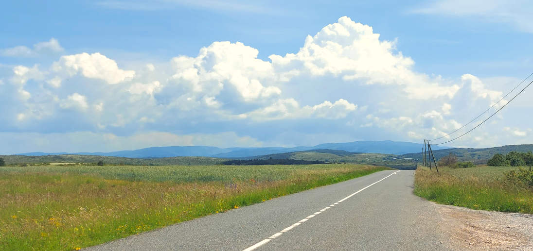
After Mende there are a number of routes across the Cevennes in the direction of Nimes and Alès - all of them on twisting roads. The route selected on this page is the most scenic and also one of the easier, as much of it is on higher ground.
Head south out of Mende on the N88 following signs for Millau, Rodez and Alès.
For the next 100 km, you will drive right through the beautiful Cévennes mountains★★, the central area of which is one of France's original National Parks.
At Balsièges, turn left onto the N106 following signs for Alès and Nimes. After 300 metres, stop following Nimes and Alès, and turn right onto the D986 signposted Ispagnac and Ste. Enimie. After 5 km bear left onto the D231 signposted Molines and Ispagnac. Two km later you will join the D31. Just before Ispagnac, at Molines, you will reach the D907B.
► 3a For the Tarn gorge route and on towards Carcassonne (pink on the map) turn right here (Jump to route guide below).
► 3b For the Cévennes route (green on the map), turn left. (Continue reading).
You are now in the upper Tarn valley ★★. Continuing on following the green route, just after the village of Molines, you'll see on your left the bottling factory for Quézac mineral water, which produces 20,000 bottles an hour. 200 metres after the bottling plant, turn right to admire a medieval stone bridge over the Tarn .It is another 10 km up the Tarn valley to the small town of Florac. Watch out here for large birds of prey circling overhead. Vultures were reintroduced into the Tarn valley back in the early 1990s, and today the valley and gorges are home to hundreds of nesting pairs. With their 2-metre wingspan, these soaring birds are easily recognisable.
At Florac ★, or just after Florac, turn right to cross the river so that you exit on the D907 following Merueis and Saint Jean du Gard. You are now driving through the heart of the Cevennes, an area with a bloody history. In the 16th and 17th centuries, people in this part of France, far from big cities, converted to Protestantism. But in 1685 King Louis XIV revoked the "Edict of Nantes", which had guaranteed religious freedom, and Protestantism was outlawed. There followed 30 years of strife in the Cevennes, during which many of the Huguenot (protestant) villages were destroyed, and the people massacred. The "Camisards" led a long-running guerilla campaign against the catholic Royalists, and Protestantism was never defeated. Today, the small towns in this area, including Florac, and many villages too, have protestant "temples" as well as catholic churches. The story of the struggle for Protestantism in the Cevennes is told in the small Musée du Désert, near Saint Jean du Gard.Mont Aigoual: at
1567 metres, this is one of the highest peaks in the Cevennes. It is
not on our route, but can be reached by continuing south on the D907
after Florac, then the D119, then the D18 and following the signs.
Don't miss the sharp hairpin turn off the D18 to the D119 in the
village or Rousses. There is a road to the top of Mont Aigoual, and on
a clear day, the views are stupendous.
Six kilometres south of Florac, turn left onto the
D983. At Col
du Rey (987 metres altitude), the D983 forks left, but you carry
straight on on what now
becomes the D9 which will take you almost to Saint Jean du Gard. You
are now on the "Corniche des Cévennes" - or Cevennes high
road -, a former royal highway first built in the 18th century to help
the King's armies to keep control over the unruly Cévennes. There are
lots of viewpoints along the way. At the
Col des Faisses
- 1018 metres, less than 2 km after the Col du Rey,
stop to admire breathtaking views over the Cévennes. On
entering the Gard department, the D9 becomes the D260 before joining
the D907 for the final 3 km to Saint
Jean du Gard.
★ This
is an attractive small town, with old buildings and the added
attraction of the Cévennes steam railway.From Saint Jean du Gard, continue to Anduze ★★ a typical small Languedocian town, with a historic clock tower, grain market and other old buildings - as well as being the other end of the line for the Cevennes steam railway. Just outside Anduze don't miss the Prafrance botanical gardens, first established in 1856, covering 34 hectares, the finest plantation of bamboos in Europe.
After Anduze, you are on the Mediterranean plain. It's still rural, but you are back into a fairly heavily populated area with lots of roads. Our recommended route will take you to Uzès ★★ a very attractive small town with famous 11th century octagonal cathedral tour, other medieval buildings, and popular markets; then to Remoulins - site of the amazingly preserved Roman aqueduct, the Pont du Gard ★★★ (UNESCO world heritage site). Cross the Rhone into Provence at Beaucaire, then carry on east to Saint Rémy de Provence ★, past the Roman remains and triumphal arch of Glanum ★★ (See Roman France) then to the ancient hilltop town and chateau of les Baux de Provence ★★. From there it's a short drive to Arles ★★★ (Roman arena, museums). After Arles, cross back to the west bank of the Rhone, and take the D570 across the Camargue ★★★ to les Saintes Marie de la Mer ★★, your destination. As you go, note the rice paddies and look out for the native white semi-wild Camargue ponies. To the east of Saintes Marie, enjoy the nature reserve with its kilometres of fine sandy beaches, accessible only on foot, on horseback or by bike; to the west, it is a short drive to the historic walled city of Aigues Mortes ★★ .
Note: between Anduze and Arles, you may want to include a visit to the historic city of ★★★ Nimes
Tarn gorge and High Languedoc route
This route takes in many kilometres of small roads, mostly built to modern standards, but in parts twisting and narrow, roads where there is no option other than to enjoy a slow drive. From Molines, the route follows the length of the dramatic ★★★ Gorges du Tarn and on to the small town of Millau. Leaving Millau on the D992, the road passes beneath the massive ★★ Millau viaduct, the highest motorway bridge in Europe. At Saint Rome de Cernon you join the D999. At Lauras, turn left onto the D23 and visit the world famous ★ cheese cellars at Roquefort, before returning to the D999 which you follow through Saint Affrique and on in a southwesterly direction. After 17 km, turn south onto the D32 at the Aire des Rougiers, following signs for Belmont and Lacaune.You are now driving through the spectacular landscapes of the Haut Languedoc regional park, through wooded valleys and open hilltops. Leave Lacaune on the D607, which soon becomes the D907. Follow this for 67 km from Lacaune to Aigues Vives. Nine kilometres before Aigues Vives, stop to admire the vast ★ panoramic view over the Mediterranean plain and to the Pyrenees beyond; then just before the village turn right onto the D910 signposted Olonzac. From Olonzac onwards, Carcassonne is on the signposts. Most visitors will want to stop and visit the magnificent ★★★ Cité médiéval, for which Carcassonne is renowned the world over.
The suggested route after Carcassonne takes you through the vineyards of Limoux, where medieval monks created the first sparkling wine, into the arid back country of the Aude department, and through the spectacular ★ Galamus gorge, where the single track road clings vertiginously to the sheer rockface. By now you're in ★★ Cathar country, famed for its medieval castles. The journey finally comes to an end in the beautiful Mediterranean fishing port of ★★ Collioure, where the eastern Pyrenees meet the sea.
► More on Languedoc: see Languedoc regional guide
About-France.com
Home page -
Site search
- Regions
- Maps of France
- Contact
Copyright
© About-France.com 2007 - 2025 except where otherwise stated.
Site
search
About-France.com
On byways through France
Previous stages (north > south )
Previous stages (north > south )
- 1. Byways through Normandy and Centre-Val de Loire. From Rouen to the heart of France.
- 2. Byways through the Auvergne, from the heart of France to the marches of Languedoc.
Gitelink
France
selected holiday cottages
Click here for
low-cost car hire in France
low-cost car hire in France
Copyright text and photos © About-France.com 2007 - 2025 except where otherwise stated.
About-France.com
is an independent and free travel information guide, funded
solely
through affiliate commission that may be earned on bookings made
through accommodation
and ticketing
portals